Wednesday, July 17, 2013

Tora Tora Tora


I almost waited too long before making a visit to one of my favorite Tiger Lily habitats to peruse this year’s bloom. I recently found that many of the tiger lilies are already fading, but an equal number of buds have still to bloom. That probably makes it the peak season right now. To find tiger lilies you need to seek them out near moist areas close to creeks and bogs. The photos I am sharing here are from an area along Pescadero Creek where there is no trail. I was making my way along the rocky creek bed and wading through several inches of water using logs and rocks as much as possible. But there are some much easier places to see tigers though. If you go to Portola headquarters and walk over to the Iverson trailhead that leads down to the creek there is usually a cluster of them right near the footbridge. Another relatively easy place is along Opal creek in Big Basin along the trail section that leads up the ridge away from the escape road. For a longer hike, Peters’ Creek grove in Portola usually has several areas with clusters of blooms. Also several areas along Skyline to the Sea trail west of the falls area will usually show leopard lilies with a more subdued coloration. These are just some suggestions, and exploring is always fun, but don’t wait; get out there as soon as possible for the best displays. They won’t be around the local areas much longer and won’t be back until next year. I uploaded a photoset on flickr if you want to see more.
California Tiger Lily (Lilium pardalinum )   


California Tiger Lily (Lilium pardalinum )

California Tiger Lily (Lilium pardalinum )

California Tiger Lily (Lilium pardalinum )

California Tiger Lily (Lilium pardalinum )

Tuesday, July 16, 2013

Tamarack Flat to El Capitan


View east from El Capitan

It seems that there is always another awesome hike to be discovered around Yosemite Valley beckoning a hiker’s spirit to get boots on the ground. If Half Dome is the most iconic feature of Yosemite Valley, then the runner up for that honor must (arguably) be mighty El Capitan. The Ahwahneechee name for the rock is Totokonoolah, which probably means something like “The Chief” or “Rock Chief”. The name El Capitan comes from the Mariposa Battalion being a loose Spanish translation of the native moniker, of which “The Captain” is truly worthy. In the early days of Yosemite as a national park, the original Big Oak Flat road (wagon road) had a very sharp curve which was referred to by guides as “OMG point”. As a wagon negotiated the curve approaching from the west, El Capitan in all its glory would become immediately and suddenly visible from a short distance, inspiring wide eyed surprise and gaping awe. Even today the same sort of effect takes place on the modern paved road as the immense granite face appears through the trees on Southside Drive. Like Half Dome, it was once considered to be impossible to climb, but today El Capitan’s 3000 foot high granite wall has become a personal challenge for accomplished technical climbers from around the world with dozens of established climbing routes. And like Half Dome, the summit is also accessible to hikers by trail.

Zoom to the Clark Range
 Lots of backpackers visit the summit of El Cap along with other points of interest while hiking some variation of the north rim trail, after first obtaining a wilderness permit. For day hikers there are actually 3 possible routes, but I would guess the most popular route must be by way of the Yosemite Falls trail from the valley floor. I hiked that route back in 2005 (pre-blog), visiting the top of the falls, and Eagle Peak along the way, which was a fantastic day of magnificent sights and great challenging hiking. My wife and I also had a memorable hike in May of 2009 on that route, but could not make El Cap due to deep melting snow that was too unstable. But there is another approach from the west which I had never done before this hike. I had planned on hiking the route from Tamarack Flat during my trip in 2012 but had a really interesting day then. On this trip we (my wife and I) finally got it in our trail log.
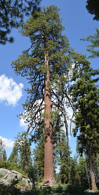
  
Jeffery Pine
Tamarack Flat is one of Yosemite’s non-reserved campgrounds. Campsites there are first-come first-served. To reach it you need to drive a narrow, rough, winding little road for about 3.5 miles from Tioga Road not far from Crane Flat. There is a small general parking area which can serve as trail head parking, but as I found out on my last trip, there are no bear lockers except for those in the campsites. On the far end is a gated trail head at about 6,165 feet. The first section begins as an old road, and is probably still used for fire access if needed. Despite the namesake, my observation of conifer populations were approximately equal amongst tamarack/lodgepole, sugar pines, and white fir. Near the campground are a few burned areas showing good recovery, but most of the forest is tall and fragrant, with quite a bit of thick lichens, and showing evidence of weathered patina common at this altitude.

After roughly half a mile you pass the first of several little creeks and begin enjoying seasonal wild flowers, most prevalent near the riparian areas (see my photos). The trail continues descending gently all the way down to Cascade Creek where there is a backpacking trail camp about 2.5 miles in. Some Yosemite hiking guides have this little hike to Cascade Creek listed as a short day hike by itself. This is a pretty area with a nice little cascade down a narrow little canyon, a beautiful little pool upstream, some rocks to explore, and abundant greenery and wild flowers. Continuing on, the trail heads gently downhill toward the junction with part of the old Big Old Flat road where there is a junction to head toward Foresta. Bearing left on a short section of the old road you finally reach the low point of the hike at 5863 feet just over 3 miles in, and bear left again to begin a rather relentless uphill.

The next section of trail climbs about 1,890 feet in roughly 2.85 miles using GPS data, and as always, GPS margin of error applies. This hike is interesting because the summit that is your destination is actually not the high point of the route. You reach the highest point at approximately 7,753 feet just before descending again to Ribbon Creek. Some portions of the trail are quite steep, while others are gentle, but the route is scenic and will keep your mind busy taking in the sights. At one point you spot what looks like a high granite ridge ahead reaching above the trees, but your ascent will eventually bring you well above that point and into the subalpine. Along one section the trail follows up along a rock slope with sparse weathered jeffery pines scattered about, some of which are very stately looking, and you can spot mariposa lilies and other wild flowers that like sun. The next section levels out somewhat and brings you through a dense wooded area which shows lots of white fir and incense cedar, and you can spot lots of pine drops and spotted coral root. Soon after cresting the top of the route the trail descends toward Ribbon Creek and along Ribbon Meadow with more wild flowers that like moist areas. After passing a boggy area with questionable water, you eventually get access to the Ribbon Creek further along where you can filter water for drinking. Ribbon Creek is the source of Ribbon fall, and is usually down to a trickle by mid summer. We found there was plenty of water flowing even though this was a very dry year. The only other potential drinking water stop is all the way down at Cascade Creek.

Alpine Lily (Lilium parvum)

Hiking on from the creek you begin climbing again and soon can begin to see across the chasm of Yosemite Valley and the immense rock structure that is abutted by  El Capitan. As you hike up along the side of the rock ridge admiring the displays of stonecrop, you eventually break out onto “The Captain” and the long range views are simply tremendous. From the top of the rock you can see its true shape. From the bottom it looks like it must be flat on top but it isn’t. El Cap is dome shaped on top and it would be foolhardy to attempt to get near the edge. This will limit the dramatic effect of being able to look over a very high precipice like you can at Eagle Peak, Half Dome, or the top of the falls. Since you cannot see straight down, you cannot even see the valley floor at all, but the long range views will be worth the effort. You also get the satisfaction that you are standing atop a genuine icon; a natural wonder. The cool mountain breeze feels really great on your face, and the mountain spirit will fill your senses. The day we did this hike there was a fire burning near Yosemite Creek deemed the “forbidden fire”, and it was high in the no-fight zone. This was making a lousy haze effect that you can spot in my photos from this hike. The total round trip elevation gain was 3,711 feet with a distance of 17 miles. I uploaded a photoset on flickr, and created a trip report at EveryTrail if you want to see more.

Sunday, March 3, 2013

Red, White, & Blue and Trilliums too


Mule deer graze at Edgewood Park

It’s kind of a bummer that the rains of early season have not continued. Now the trends are again for a dry season overall. The Sierra snow pack is now reported to be at only 60 % of normal after what had seemed like a bountiful fall. I’m beginning to wonder if there still is a “normal” weather profile for California, or indeed the rest of the nation. But despite of the drop-off in precipitation, its still getting interesting along the trails in the bay area. I believe it was Jane Huber who first coined the phrase "red, white, & blue" describe the first early season blooms, almost as though nature was doing a little flag waving. Or more specifically, Indian warrior, milk maids, and hound’s tongue, which always spring forth early, at about the same time, as though it would be more appropriate for 4th of July. I’ve also been enjoying seeking out fetid adders tongue in various places lately, not that their greenish and brown coloration would fit that theme very well. It’s just as well though because they are already shedding their blooms leaving only mottled looking leaves. Well now you can add trilliums to the mix as they are showing up now too. I found some really great looking giant trilliums yesterday which are showing some interesting color variations from the usual dark purple or white blooms. I am also seeing lots of white and pinkish western trilliums popping out now, and even spotted a few un-bloomed pods of mission bells. Bird calls are beginning to resonate throughout the forests now too. I don't recognize all of them, but I recorded some video clips with sound. Unfortunately I couldn't get them to load for some reason, but I added some photos below and more at the link provided. With the weather as accommodating as it is now, out on the trails are where you want to be. I just hope we get some more rain (and snowpack) in March.

Click here to see more photos on flickr

Giant Trillium; (Trillium chloropetalum)

Pacific Trillium; (Trillium ovatum)

Giant Trillium; (Trillium chloropetalum)

Pacific Trillium; (Trillium ovatum)


Sunday, February 10, 2013

Late Winter Roaming

Coyote Ridge Trail
 I thought it was about time I did a new blog post even if for no other reason than to dispel any notion that I had somehow dropped off the planet, or perhaps had achieved true nirvana, which would naturally make things like blogging seem like a total waste of time. I suppose the former seems more likely but the latter makes a better excuse than being lazy. I am after all still earthbound, still out on the trails whenever the opportunity presents itself, and still warding off nature deficit disorder by taking sanctuary in the natural world. Without being able to get away very much I’ve been hiking in mostly very familiar places all winter, so I feel like a bit of a shut-in, even though that’s not really true either. Without being really inspired to blog about any one particular hike I’ve done in the past few months, there are still those subjectively interesting moments of personal encounter with nature that are the essence of the hiking experience. It is those interludes of communion; those touch points with nature; that keep me rambling.

Berry Creek Fall
The falls at Big Basin were epic this year following the ample December rains in 2012. On New Year’s Eve day the falls were at their best that I remember since 2004, and have not really tailed off since. At first the water was hazy and full of silt, but quickly cleared in the following days. The ground in the redwood areas is retaining lots of water. This can be evidenced when you spot a fresh tree-fall where the roots have been torn up. The craters left by the root system are filling up into virtual ponds by seepage. The Santa Cruz Mountain forests have plenty of seasonal beauty in winter if you know what to look for. Brilliant lichens and fungi are adding lots of color and character, and I love the effect of having the morning mist illuminated by the sunbeams, and of course the water course sounds are a great embellishment. Hiking the redwoods is never out of season, least of all now (photoset link).

Hiking in Sanborn a few weeks ago we were treated to a winter feeding party as masses of wild doves were singing with delight while darting around devouring madrone berries. Their songs could be heard from half a mile away as you approach a thick stand of tall madrones bearing their avian fruit. The debris left from the foraging doves was littered all over the trail. I used my Cannon point-n-shoot to get a video even though the lighting was not good enough to see very much. The reason I posted it was to share the sound recording of the bird calls. (The video is posted at the bottom of the post). I could not make an exact ID, but I think they are Mourning Doves (Zenaida macroura). They also have the peculiar behavior of bursting into flight as a flock when one gets a little startled. A large flock can beat the air into a palpable air wave. I remember one time winter hiking in Henry Coe when I inadvertently startled a large flock of doves near Mazanita Point, and the intensity of their sudden mass wing flapping really startled me for a moment. I did not realize it then, but they were also probably there to feed on the winter madrone and manzanita berries.Check out the video at the bottom to hear the bird calls.

Fetid Adder's Tongue (Scoliopus bigelovii)
Last year about this time I remember reading this post from Katie on the Nature ID blog about finding fetid adder’s tongue blooming in late winter. I had wanted to follow up with my own sighting, but I have only seen this unusual wild lily sporadically in deep forested regions over the years. I had tried without success to spot some more to get photos of. Later on in the year I had remembered sighting the distinctive leaves that had long shed their blooms along several trail sections in PescaderoCreek. I went back there this year searching in both Portola and Pescadero Creek, and have spotted lots of them for the last couple of weeks. I have also seen on-line reports of fetid adder’s tongue blooming at Henry Cowell. I had not realized how brief their bloom season is. I have found that the best way to spot them is to look for the distinctive blochy looking blade-like leaves. The flowers are brown colored and camouflage extremely well on the forest floor making them nearly impossible to spot. They are also not easy to photograph in the low light of the winter canopy (photoset link). In any case; now is the time to get out and see them. They will not be around long and the displays change from week to week. The best areas seem to be deep redwood canopy where you see lush understory. Hiking in Pescadero Creek also gave me the opportunity to pay another visit to one of my favorite old growth trees with my good camera along. Simply called “the Big Tree” on the map, it is an amazing example of ancient coast redwood. I wrote about this tree in my post called “Point Lost” dated September 30, 2011 (photoset link).

For one last note, I would like to share the article recently posted in the Monterey County Hearld as forwarded by Sempervirens Club on Facebook. It describes the new plans for some long awaited improvements to Castle Rock State Park. It is really exciting to learn of these plans after not so long ago being worried that Castle Rock was on the infamous closure list. Sempervirens Fund was instrumental in removing the park from closure by their donations. The private land trust has actually been in possession a great deal of property around the greater Castle Rock area that is still closed to the public. A large portion of this land is former water district land that was purchased by Sempervirens for preservation, with the addition of another 33 acres of private land, but these tracts have never been fully realized in terms of public recreation. That situation looks about to change in the years to come if this plan becomes a reality. There is potential for some great new hiking trails to go along with some well thought out public amenities. This is the best news for south bay hikers for some time. Won't it be great in the coming years when Mt Umunhum opens up with new trails, new connections, and new vistas, along with a bunch of new trails at Castle Rock providing access to many new acres of prime mountain habitat to be preserved going into the future generations. I created a new Winter Roaming photoset on Flickr.


Monday, October 22, 2012

Alta Peak


View to Triple Divide Peak

Another of the great day hikes I did on my recent trip to Sequoia National Park was the hike to Alta Peak. This is a back post from that late September trip. I had not ever completed this hike before doing this trip, so it seemed like a new experience. Some years ago before starting up this blog, I made use of this same trailhead to hike to Pear Lake which was a memorable day, but my only other hike from Wolverton was an early season attempt at Alta Peak which I couldn’t complete. I was too early in the year and encountered dangerous conditions with deteriorating hard pack up in the higher reaches of the trail.

This time I had near perfect conditions except for the usual faint hazy/smoggy muck that always hangs in the air when you are this far south. Even in spring that kind of SoCal haze; partially natural but mostly human origin; has a tendency to hang in the air like a cheap suit on a sumo wrestler. Unless you hike right after a rain shower, you can always expect at least a slight haze effect stubbornly reminding you of our society’s over-dependence on fossil fuel. The best route to Alta Peak begins at a place called Wolverton. There are other routes to get there, but this hike has about 4,000 feet of vertical gain to the peak, so extra distance will only burn more time and energy. Better to use the shortest route leaving you time to enjoy the stellar views from summit and still make it back before the coin-op showers close at Lodgepole. Not to mention the store with its unexpectedly good selection of cold beer. Having these niceties at hand is rare and I took full advantage during my stay. Wolverton has plenty of trailhead parking and is easily reached from a signed turn off from General’s Highway a short distance from Lodgepole.

View from Panther Gap
Beginning on the Lakes Trail, the hike predictably begins within tall stands of mostly Red Fir at about 7,200 feet and immediately begins gently climbing. The forest is beautiful and fragrant leading past pretty meadows, and lush water courses, while climbing steadily but gradually. It didn’t take long before spotting wildlife. I spotted one large adult black tail buck, which managed to elude my camera, and further along I came across a couple of yearling black tail bucks, undoubtedly siblings, play-jousting as is typical of growing males in the wild. I tried my best to go unnoticed, but it was funny when they spotted me on the trail. They stopped for a few moments appearing slightly startled. They both stared at me as if puzzled, and seemed to size me up for awhile. Before long I suppose they determined that I was not threatening enough to be concerned with, and they just continued their antler wrestling shoving match for my amusement. I sat on a log and quietly watched several “falls” of play-jousting and even shot some video before they finally wandered off. It was all very cute. I posted a video at the bottom of the post.

View south from the peak
The first junction comes at 1.8 miles where the Lakes Trail goes left toward Pear Lake, and to the right the trail continues another 1.1 miles to Panther Gap at 8,400 feet. Up until this point the hike has been a gradual uphill forest hike with a thick canopy overhead. At Panther Gap you begin to get great views to the south across the chasm that holds the Middle Fork Kaweah to the green mountainous range beyond and you can see the Castle Rocks. Not bad for only just under 3 miles of hiking. After making the turn toward Alta, the trail follows along the southern slopes of a high rocky ridge which provides really great uninterrupted views to the south as you walk. Looking up to the other side you can spot many interesting rock formations high above. The trail along this section is mostly exposed and at some points has some steep drop-offs on the down side. You don’t want to be careless with your footing along there, but the visual input should easily inspire this caution to intelligent beings. Several water courses still had a few wild flowers even this late in the year. After just about 2 miles of admiring very nice views you have already passed the cutoff to the High Sierra Trail and have reached the junction to Alta Meadow. The meadow area is a great little side trip, and camping permits available. At this point, if you start running the numbers in your head you can start to get a little feeling of dread. My altimeter was reading 9,251 feet with the odometer reading 4.83 miles. The peak is known to be just over 11,000 feet and about 6.8 miles. Even using new math that still means the final 1.9 miles or so to the summit needs to climb over 1700 feet, which only reminds me why I waited until the last couple of days of my trip before doing this hike. Better to wait until you’ve had some acclimation time because heavy breathing follows.

Looking east from Alta Peak
If you look up from this junction you can see the rock outcrop called Tharp’s rock, and if you are unfamiliar with the trail could maybe mistake that for the summit. But by the time you reach Alta Peak you will be well above looking down on Tharp’s Rock. After making the turn the trail at first has led back into the tall red firs and you get some nice shade. There are a couple of well place watercourses on the way which seem perfectly located for topping off your water supply (using a filter) before making the final push to the summit. Soon the trail bends around and you begin to get views to the east and the stark peaks of the western divide. As you enter the sub-alpine the firs are gone and sparse weathered foxtail pines (Pinus balfouriana) dot the rocky landscape. The trail then begins a series of steep exposed switchbacks marked with cairns. The trail is easy to follow just by the usage evidence, but the cairns are the best reference. As you approach the top you can see that the actual summit is a jagged peak. With careful scrambling, you can reach the summit register locked in an old ammo box. The panorama is amazing. To the east you can see the entire serrated peaks of the Great Western Divide dominated by Triple Divide Peak and spreading as far as you can see. To the south you can see the landscape falling away in gradually descending mountain waves, all the way out to the central valley. And all around are mountainous views and deep valleys. You can see down to Alta Meadow in the shadow of the divide, and on the other side to Pear and Emerald Lakes. You need to spend some time to take it all in while enjoying the breeze. My altimeter was reading 11,120.3 feet. The hike back is really nice because you can still admire the views while heading down. The trail never does climb up and over any pass or gap, so the way up is all up, and the way down really is all downhill with the lower sections being a gentle grade. I absolutely love this trail. I uploaded a photoset to flickr and a created a trip report with a track log on EveryTrail.

Friday, October 19, 2012

Reprieve for Umunhum’s Tower (for now)


Mt Umunhum's skyline will feature the "cube"

This is late news by now, but I will go ahead and follow up on it. Midpeninsula’s public meeting on the evening of October 17 to vote on a resolution concerning Mt Umunhum’s radar tower was well attended and productive. Sue and I both attended, but didn’t stay until the end. I had an early morning ahead, and couldn’t help wondering what was happening with the Giants in the playoffs. I would estimate that 25 to 30 people in all got up and gave their comments which were limited to 2 minutes. Sue decided to get up and speak, and I declined. Of course the majority of the speakers were indeed a vocal minority in favor of preserving the cube, and for “going all in” on the idea of saving the cube; which was the phrase they seems to rally around, which basically translated into; You people at MidPen should quit messing around and just do whatever we ask, and by the way, you should also pay for it regardless of cost. According to a survey conducted by the board of the district constituents, about 1/3 of respondents were in favor of keeping the tower. The rest were split between the other 2 options, so the meeting attendance was obviously not truly representative of prevailing public opinion. Even still the meeting was polite and respectful, and eventually had a very productive outcome. The option decided on was to adopt what was called interim action A. The district will do temporary repairs on the tower in order to arrest decay and mostly preserve the tower for a period of 5 years. During that time the proponents of the save-the-cube petition will have time to raise the funding for doing a better job of permanently preserving the tower. There are already some pledges of support, and the County Historic Heritage Commission sent the board a letter stating it is willing to work with the board to designate it on the county inventory for landmarks, which would make it eligible for grant funding. But the best part is that in the interim, the district can go forward with plans to open the site for public access.

I am quite happy with this outcome. My biggest dread was that all this wrangling would further delay the opening, but now it appears it won’t. I am also actually happy that there is a way forward that provides for preserving the radar tower without burdening the district with the additional costs. In my opinion this seems like a win-win scenario, and is fair for the very reasons I stated in my last post. I am expecting that the deal will eventually come together to preserve the tower, and that the cube is now here to stay.


Click here to read the article posted in the San Jose Mercury News dated 10/18.
Click here to see MidPen’s updated project page.

Wednesday, October 10, 2012

Whither the “Cube”


Mt Umunhum's radar tower

Look to the southwest from anywhere in the south San Francisco bay and you can spot it up there on the mountain. If you get high enough in the Diablo range you can spot it from more than 50 miles away with the naked eye. So what is that huge boxy looking thing way up there? Its Mt Umunhum’s derelict remains of a cold war era radar tower. Long decommissioned, it sits there crumbling. So the question is; is that huge monolithic “cube” sitting there on the summit a glaring eyesore marring the skyline of the coastal mountain range, or is it really an important historical relic that deserves to be preserved? That is one of the most important questions to be addressed at the next public meeting scheduled for the evening of October 17th in Sunnyvale. Go to the Mt Umunhum project page on MidPen's website to learn more.

It seems that history can have a very different context depending on how you choose to look at it. Natural history of course would be that of the flora and fauna that flourished unimpeded across this range for untold centuries. Make no mistake; in times past, the natural beauty of this region as documented by first hand accounts in early times is nothing less than glorious. One only needs to read the personal account of John Muir’s 1868 ramble from San Francisco to Yosemite in order to get a sense of what the overall San Jose area looked like before being overtaken by modern times. It’s a classic. Sierra Azul is actually one of my favorite wild flower sites. Also of significance is the role of the mountain in the lore of the Ohlone people that dwelled here for many generations, long before Europeans had ever come to these shores. Modern history however is a very different story. Modern history brought us the history of the cold war and of the Almaden Air Force Base. The radar station that was built on top of Mt Umunhum was one amongst a series of similar sites that formed part of a defensive network of outposts keeping watch on the coast. First operating in 1957, and evolving thereafter, there were probably thousands of military personnel that once worked and/or lived there in the line of duty. The base was a bustling nerve center before technology finally outpaced it making it obsolete and leading to its decommissioning.

View to Mt Umunhum
Fast forward to present time; the site is now owned by MidPeninsula Open Space District. The district has been involved in a long and laborious cleanup and restoration project for years, with the eventual goal of opening the summit to public access as open space. The original vision was for a return to natural habitat, demolishing all remnants of the former Air Force base following toxic material cleanup. Following that the site would be allowed to slowly return to something like its former glory. The more simple and cost effective plan is for an unobstructed panorama of view, a decent road, parking areas, restrooms, a few picnic tables, some interpretive boards, additional hiking trails, and that’s about it. Give it back to nature. After all, lots of people see the tower merely as an ugly intrusion on the natural landscape, my own wife among them. Personally I am fine with that plan, and in fact have been eager to welcome the public opening, but there are others that have a different vision for what should happen on the site, and how the site should be developed.

There is a petition now being circulated to save the radar tower. The proponents of this petition, which appears to have been spearheaded by a group of retired service personnel, are of the opinion that the radar tower has historical significance and should be saved regardless of cost. They offer no financial planning or support for this idea, but that is their desire. This group has further deemed that they would like to have a visitor’s center constructed which would contain historical information about the cold war military history of the site with the centerpiece being the preserved radar tower. They further expect for the site at Umunhum to be grand enough to rival those of Mt Diablo or Mt Tamalpias in order to properly pay homage to what they see as the important historical context of the former Air Force base. And to top it all off, they expect for MidPen to cover all the additional costs to preserve the crumbling concrete cube, and construct all of the elaborate accruements they desire. One newspaper article published in the San Jose Mercury even makes a passing reference to the possibility of a lawsuit being files in an attempt to prevent the district from demolishing any of the remnants of the former Air Force base without being formally reviewed by the county for any historical significance that they might deem exists in all that decomposing and formally toxic debris.

In any case, The Mt Umunhum project page on MidPen’s website includes three possible options for how to approach this issue. The first option is to go ahead with the original plan to demolish all remnants of the base, including the tower, and return the summit to as near as possible to a natural state. The second option is to partially demolish the tower, and keep only the first floor outer wall of the structure, forming it into an open air monument. The third option is to completely seal and preserve the immense cube. Artist conception drawings are presented of all three options. The MidPen website makes no mention of any visitor’s center structure.

With all due respect to the military history of the site, and to those who performed their duty by serving there, in my opinion the real historical significance of the Air Force base is quite minimal. The site is not unique, and there were no battles fought there. It’s not like it was freakin Omaha Beach or Gettysburg or something like that. I suspect these guys actually had it good there compared to those who served in a real fighting war in some God forsaken corner of the world like some of my old friends. I would imagine that it was not unlike the duty that I myself performed when I in the service. I too am also a former serviceman, and during my 4 year stint on active duty in the 70s, I was stationed at Teufelsberg in Berlin. Teufelsberg was at the time a top secret facility with an intensive, live, cold war ear mission shrouded in mystery. We worked very hard, but we always had it comparatively good. I have to admit it makes me a little sad to see pictures on the internet of the dilapidated condition of the Teufelsberg site following it’s decommissioning after the close of the cold war era. And like Umunhum, it has a group of former servicemen who are trying to save it. In my opinion it’s really up to the people who live in the region to decide whether they think Teufelsberg is important to their history. Or is it just an eyesore?

Let me be clear about one thing. I would support the idea of preserving the tower, and even of constructing a visitor’s center, provided that some alternative funding can be worked out. I do not support the idea of forcing MidPen to pay for these costly developments if that is not part of their vision. As stated earlier, I do not support the idea that the tower on Umunhum has significant historical value. Just because it was military doesn’t make it noteworthy enough to sweat over. Sorry, but nothing really historical happened there. Sorry if that make anyone angry, and I mean no disrespect, but it’s the truth. If some county historical board decides to declare different, then we will all be forced to accept it, but in my opinion the natural value of the site and the profile of the landscape are more important than a gigantic monument to a bunch of people who were, at the end of the day, just doing their duty, like the countless many who served at other military outposts all over the world who have no monument to their service. Not to mention those who really sacrificed, and even paid the ultimate price, and likewise have no monument.