So many peaks – so little time. This was our lament upon leaving Juneau, Alaska. My wife and I could have easily lingered here for a week or more doing little more than hiking trails and drinking in the landscape. But alas, this was only a one-day port of call on our packaged tour. Thirteen of us on a family vacation to tour the inside passage, and two national parks. Sue and I love to hike most of all, but we got very little opportunity to do so while on this combined cruise and land tour. This hike was only a sampling of the offerings available should we decide to return to Juneau sometime without an itinerary, which I would be thrilled to do.
 The city and borough of Juneau, situated on Alaska’s panhandle, has a total area larger than the states of Rhode Island, or Delaware, and nearly as large of both of them combined, with a population of only 30,711 by the last census. Juneau is the capital city of Alaska despite the fact that there are no roads or rail system leading here. The only access being by sea or air, the area is dominated by steep peaks ranging up to 4000 feet above the harbor.
The Mt. Roberts Trail normally begins by climbing a flight of stairs on a city street. Some of the areas on the outskirts of the city center are so steep that there are stairs leading between streets. A section of the lower trail was damaged by a recent rockslide, so there was a slight detour around using the unpaved Basin Road. This road provides access to the historic Perseverance Trail, and the Mt Juneau Trail, which climbs 3500 feet in only 2 miles, and links with many other tempting backcountry trails.
 The lower trail begins within rainforest terrain, primarily spruce with some aspen, hemlock, and cottonwoods. They measure rainfall here in feet, not inches. The understory is dominated by the very leafy and thorny devil’s club, and lots of small fern species, moss and lichen. The trail is in good shape, and graded with switchbacks so it’s not wicked steep. Actually this entire section could be skipped by taking the tram up to a restaurant, bar, and gift shop located at 1760 feet. The round trip is 25$, but there is also a hiker option to ride the tram down only for 5 bucks. The summit is 4.5 miles and 3819 feet in elevation gain.
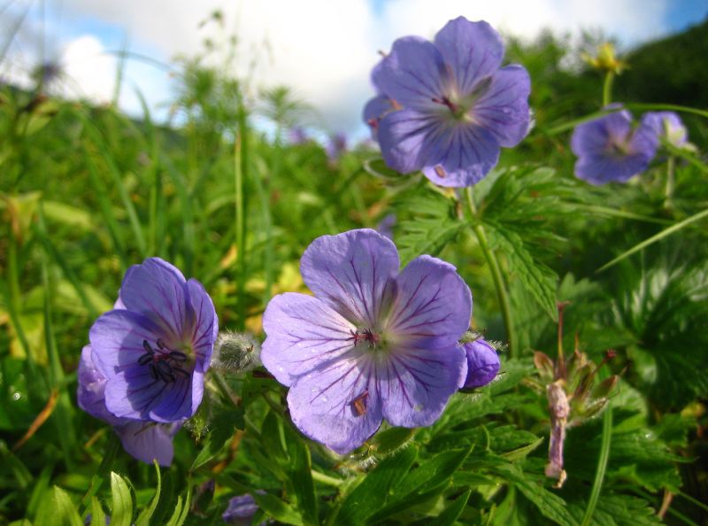
Once above the tree line, the views are simply breathtaking. Our ship docked very early in the morning and all aboard was at 8:00 PM. It was pure luck that we got a mostly clear day. It was foggy in the morning but later on it cleared, with intermittent patches of misty fog drifting through. The clearing pockets revealing snowy peaks in all directions, panoramic vistas, and a stunning view down to Gastineau channel and the city of Juneau. I wish I could bottle the smell of the crystal clean air. We were at the very end of the wildflower season, but there were still plenty enough around to complement the experience nicely. There are black bears in this area, but we never observed any evidence of them. We did see a lot of grey marmots, spruce grouse, and forest birds. There were still a few patches of snow on the highest trail sections, but nothing requiring special gear. We chose the option to take the tram down to save time because Sue really wanted to attend a talk/presentation and book signing by Libby Riddles, the first female to win the Iditarod dogsled race. But it was hard not to linger longer at the peak. This whole area is gorgeous and doesn’t get oppressively cold, but does get copious amounts of rain. Click here to view my flickr pix. My brother-in law Dave was on a similar hike the same day only they took the tram. Click here to view Dave's pictures (www.pixseal.com).
Click here to read a follow-up post from our hike on the same trail in 2011.


2 comments:
So, someone could do this hike in a day? We arrive at 6:30am in Juneau and leave by 4pm.
Hi Jennifer,
Sorry for the delay in responding. I just got back from a Sierra trip. Yes, this hike can definitely be done in a day. There is no camping up on Mt Roberts, or Gastineau Peak. The round trip distance is about 7.7 miles, but we took the tram back.
Here is a more recent write up
http://randyswaypoints.blogspot.com/2011/09/gastineau-peak.html
Here is a GPS track log
http://www.everytrail.com/view_trip.php?trip_id=1228453
Post a Comment